SPE11C overview
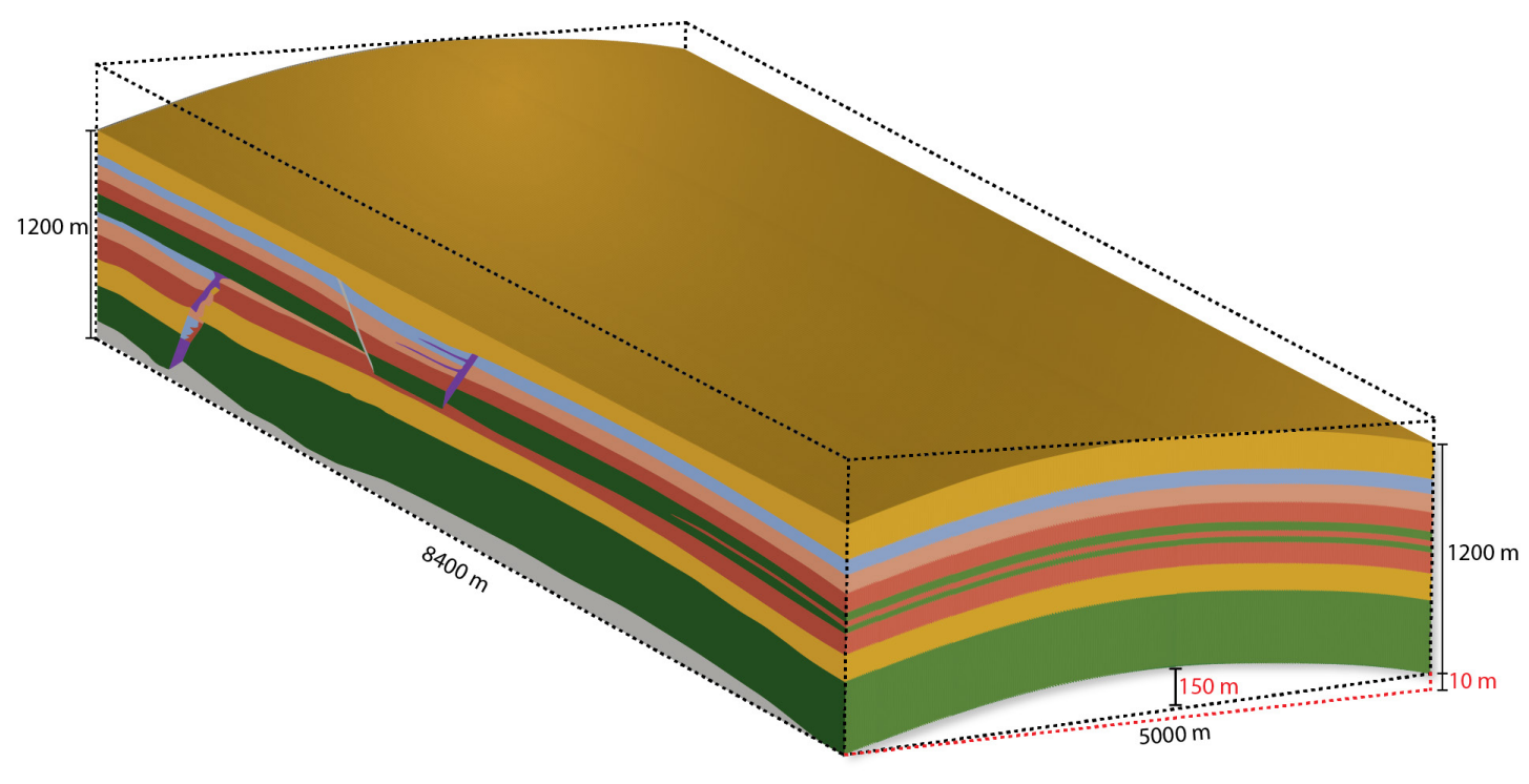
This subcase is a three-dimensional extension obtained by extruding the geometry of SPE11B along a parabolic shape. It is characterized by the following features:
- Domain and geometry: The areal footprint of the domain is 8.4 km by 5 km, with a uniform vertical thickness of 1.2 km. The deformation follows a parabolic shape, with the maximum elevation occurring near the center at approximately 150 m. To accommodate the 3D geometry, Well 1 was designated as a straight well, while Well 2 was designated to follow the parabolic extrusion of the geometry. Each well is placed in the central 3 km of the domain.
- Boundary conditions: As for SPE11B, the boundary conditions implement a buffer volume to mimic the embedding of the domain into a larger aquifer structure. The top and bottom boundaries are set to constant temperature, consistent with a geothermal gradient of 25°C/km and a reservoir depth of approximately 2 km.
- Facies and permeability: Same as in SPE11B, but with minor adjustments for the three-dimensional extension of the domain.
- Initial conditions: Same as in SPE11B.
- Injection conditions: Same as in SPE11B, except the injection rate is approximately 1.5 megatons CO2 per year for each well.
- Reporting schedule: Sparse data are reported as 10 data points per year, while dense data are collected at selected time intervals. The reporting grid for dense data is a 50 m by 50 m by 10 m Cartesian grid, containing approximately 2 million cells.
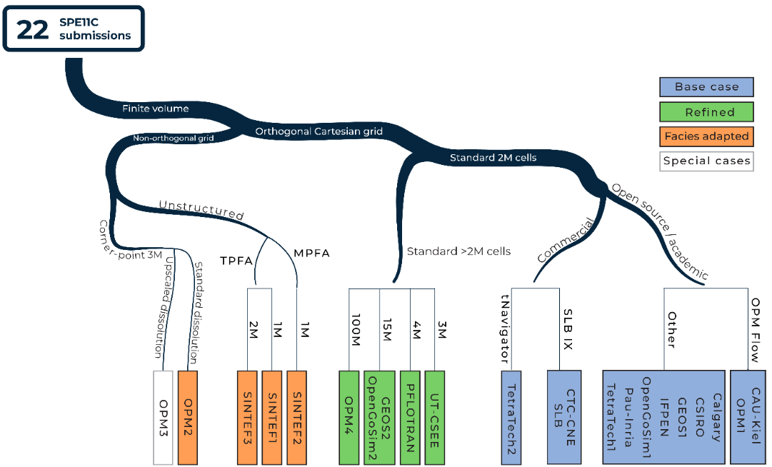
Overview over results